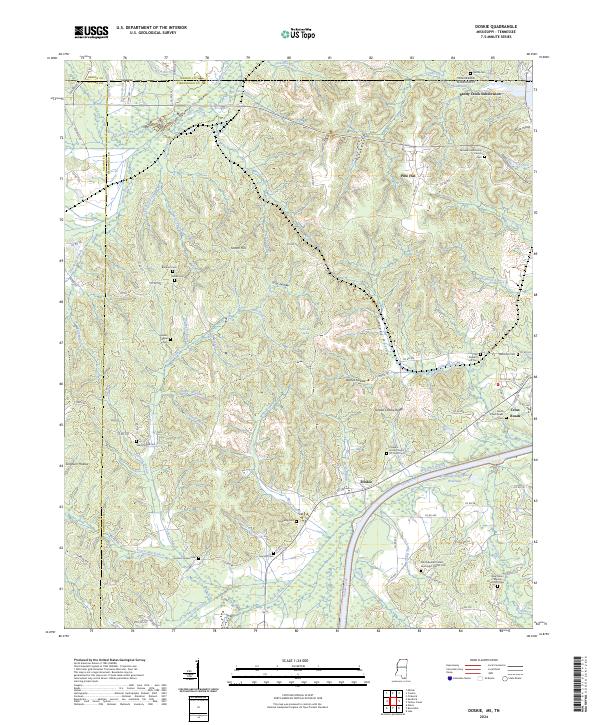
2024 Map of Doskie
USGS Topo · Published 2024About this map
Yellow Creek flows through this borderland where Mississippi meets Tennessee, shaping a landscape defined by deeply cut hollows and family-named cemeteries. In the southern half of the map, the Tennessee-Tombigbee Waterway cuts a straight, modern path across the traditional drainage of Little Yellow Creek. The settlement of Doskie sits west of this massive infrastructure, while Cross Roads occupies the eastern highlands near the Alabama line. The area is dense with genealogical markers, from the Grissom Chapel Cem and Mulberry Cem in the bottomlands to Old Pleasant Hill Cem on the ridges. Notable terrain features like Yankee Charlie Ridge and Scotch Hill reflect the heritage of the early settlers who navigated the complex topography between Sandy Creek and the river. Numerous small waterways, including Leitch Mill Branch and Wayne Branch, suggest a history of local industry and water-powered commerce that predates the modern waterway.
Find a feature on this map
123 named features on this map. Tap any name to fly to it.
Don’t see what you’re looking for? This feature index may not catch every label — zoom into the map to look around manually.
Map Details
Editions of this 2024 Doskie Map
This is the sole edition of this map. No revisions or reprints were ever made.
Other maps of this area

1911 · Iuka
USGS Topo · 1:48,000

1914 · Iuka
USGS Topo · 1:62,500

1935 · Doskie
USGS Topo · 1:24,000

1935 · Iuka
USGS Topo · 1:24,000

1935 · Leedy
USGS Topo · 1:24,000

1935 · Glens
USGS Topo · 1:24,000

1936 · Counce
USGS Topo · 1:24,000

1936 · Kendrick
USGS Topo · 1:24,000

1936 · Shaws
USGS Topo · 1:24,000

1936 · Pickwick
USGS Topo · 1:24,000