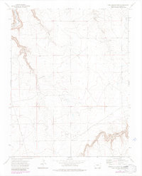
1972 Map of Doss Canyon South
USGS Topo · Published 1985About this map
Purgatoire River carves a deep path through the northwestern corner of this 1970s landscape, which is defined by a network of steep drainages including Doss Canyon and Bachicha Canyon. The terrain shows signs of remote infrastructure and land use, with a prominent Pipeline and several Landing Strips situated on the higher plateaus. Local history is anchored by the Pleasant View Cem, providing a specific point of interest for genealogists tracking family ties in this corner of Las Animas County. The map details a transition from the winding canyon floors of Henry George Canyon to the more accessible uplands crisscrossed by a Jeep Trail, illustrating how the geography dictated the placement of transportation and utilities in the high desert.
Find a feature on this map
20 named features on this map. Tap any name to fly to it.
Don’t see what you’re looking for? This feature index may not catch every label — zoom into the map to look around manually.
Map Details
Editions of this 1972 Doss Canyon South Map
4 editions found
Other maps of this area

1891 · Mesa De Maya
USGS Topo · 1:125,000

1893 · Mesa de Maya
USGS Topo · 1:125,000

1955 · La Junta
USGS Topo · 1:250,000

1958 · La Junta
USGS Topo · 1:250,000

1968 · La Junta
USGS Topo · 1:250,000

1972 · Johnson Canyon
USGS Topo · 1:24,000

1972 · Doss Canyon North
USGS Topo · 1:24,000

1972 · Miners Peak
USGS Topo · 1:24,000

1972 · Doss Canyon South
USGS Topo · 1:24,000
1972 · Painted Canyon
USGS Topo · 1:24,000