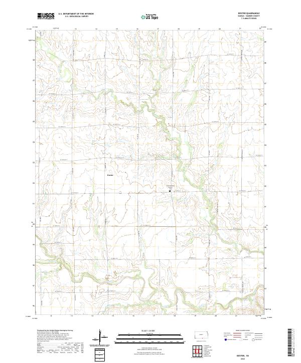
2022 Map of Doster
USGS Topo · Published 2022About this map
Doster sits at the heart of this agricultural landscape in southern Kansas, where a rigid grid of section-line roads defines the rural economy. This 2022 survey captures a transition in water drainage, as numerous small waterways like Spring Cr and E Br Fall Cr converge into the larger Bluff Cr and Wolf Cr systems. The topographic detail reveals the subtle rise and fall of the plains, punctuated by small drainage draws that break the geometric precision of the fields. For genealogists and local historians, the presence of the Cesko Slovanky Hrbitov Cem serves as a significant marker of the region's cultural heritage, preserving a specific link to the area's ancestral settlement patterns. The map's detailed road network, including S Conway Springs Rd and S Milan Rd, provides a clear view of the modern infrastructure still following the historic Public Land Survey System boundaries.
Find a feature on this map
29 named features on this map. Tap any name to fly to it.
Don’t see what you’re looking for? This feature index may not catch every label — zoom into the map to look around manually.
Map Details
Editions of this 2022 Doster Map
This is the sole edition of this map. No revisions or reprints were ever made.
Other maps of this area

1889 · Caldwell
USGS Topo · 1:125,000

1893 · Caldwell
USGS Topo · 1:125,000

1897 · Caldwell
USGS Topo · 1:125,000

1955 · Wichita
USGS Topo · 1:250,000

1955 · Enid
USGS Topo · 1:250,000

1958 · Enid
USGS Topo · 1:250,000

1958 · Wichita
USGS Topo · 1:250,000

1968 · Renfrow
USGS Topo · 1:24,000
1968 · Medford NE
USGS Topo · 1:24,000
1968 · Wakita NE
USGS Topo · 1:24,000