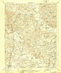
1918 Map of Doswell
USGS Topo · Published 1932About this map
Hanover Courthouse serves as a prominent anchor in this landscape defined by the winding paths of the Mattaponi River, North Anna River, and Pamunkey River. Surveyed during the World War I era, the map reveals a rural Virginia county structured around vital rail connections, including the Richmond Fredericksburg and Potomac and Chesapeake and Ohio railroads. The junction at Doswell marks a significant intersection of these lines, surrounded by a network of small settlements like Taylorsville and Penola.
Find a feature on this map
111 named features on this map. Tap any name to fly to it.
Don’t see what you’re looking for? This feature index may not catch every label — zoom into the map to look around manually.
Map Details
Editions of this 1918 Doswell Map
4 editions found
Other maps of this area

1887 · Spottsylvania
USGS Topo · 1:125,000

1889 · Fredericksburg
USGS Topo · 1:125,000

1890 · Goochland
USGS Topo · 1:125,000

1892 · Fredericksburg
USGS Topo · 1:125,000

1892 · Spottsylvania
USGS Topo · 1:125,000

1892 · Goochland
USGS Topo · 1:125,000

1894 · Fredericksburg
USGS Topo · 1:125,000

1894 · Richmond
USGS Topo · 1:62,500

1895 · Richmond
USGS Topo · 1:62,500

1918 · Doswell
USGS Topo · 1:62,500