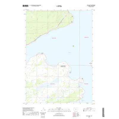
2017 Map of Dot Island
USGS Topo · Published 2017About this map
Yellowstone National Park encompasses this high-altitude landscape where the vast waters of Yellowstone Lake meet a series of complex shorelines and islands. The northern portion of the map is defined by the sweeping curve of the Grand Loop Road-West Thumb-Fishing Bridge, which traces the shoreline near Sand Point and Rock Point. This thoroughfare serves as the primary artery for movement through the park's interior, connecting the geothermal interest of West Thumb with the northern reaches of the lake.
Find a feature on this map
19 named features on this map. Tap any name to fly to it.
Don’t see what you’re looking for? This feature index may not catch every label — zoom into the map to look around manually.
Map Details
Editions of this 2017 Dot Island Map
This is the sole edition of this map. No revisions or reprints were ever made.
Other maps of this area

1885 · Lake
USGS Topo · 1:125,000

1885 · Gallatin
USGS Topo · 1:125,000

1885 · Gallatin
USGS Topo · 1:125,000

1886 · Shoshone
USGS Topo · 1:125,000

1886 · Canyon
USGS Topo · 1:125,000

1888 · Shoshone
USGS Topo · 1:125,000

1895 · Shoshone
USGS Topo · 1:125,000

1895 · Canyon
USGS Topo · 1:125,000

1895 · Lake
USGS Topo · 1:125,000

1896 · Lake
USGS Topo · 1:125,000