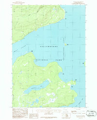
1986 Map of Dot Island
USGS Topo · Published 1986About this map
Yellowstone Lake dominates this 1986 provisional survey, revealing the intricate shoreline of the West Thumb and the isolated landforms of Dot Island and Frank Island. The map documents a landscape defined by the water's edge, where specialized geological features like Sand Point and Rock Point mark the transition from the timbered uplands to the expansive lake surface.
Find a feature on this map
15 named features on this map. Tap any name to fly to it.
Don’t see what you’re looking for? This feature index may not catch every label — zoom into the map to look around manually.
Map Details
Editions of this 1986 Dot Island Map
This is the sole edition of this map. No revisions or reprints were ever made.
Other maps of this area

1885 · Lake
USGS Topo · 1:125,000

1885 · Gallatin
USGS Topo · 1:125,000

1885 · Gallatin
USGS Topo · 1:125,000

1886 · Shoshone
USGS Topo · 1:125,000

1886 · Canyon
USGS Topo · 1:125,000

1888 · Shoshone
USGS Topo · 1:125,000

1895 · Shoshone
USGS Topo · 1:125,000

1895 · Canyon
USGS Topo · 1:125,000

1895 · Lake
USGS Topo · 1:125,000

1896 · Lake
USGS Topo · 1:125,000