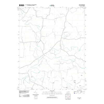
2010 Map of Dot
USGS Topo · Published 2010About this map
Whippoorwill Creek and the Red River carve a meandering path through this southern Logan County landscape, where the rural character of the region remains defined by its watercourses and a dense network of family-named roads. The map reveals a high concentration of ancestral burial grounds, such as the Ragsdale Cemetery, Moses Cemetery, and Brakefield Cemetery, offering significant value for genealogical research. The drainage patterns of the South Fork Red River and Spring Creek dictate the layout of local thoroughfares like Logan Mill Rd and Crawford Store Rd, suggesting a history of local commerce tied to these specific hubs. The confluence of these creeks and the naming conventions of roads like Camp Ground Rd and Smith Grove Church Rd point to longstanding community gathering points in this part of Kentucky near the Tennessee border.
Find a feature on this map
50 named features on this map. Tap any name to fly to it.
Don’t see what you’re looking for? This feature index may not catch every label — zoom into the map to look around manually.
Map Details
Editions of this 2010 Dot Map
This is the sole edition of this map. No revisions or reprints were ever made.
Other maps of this area

1950 · Allensville
USGS Topo · 1:24,000

1950 · Olmstead
USGS Topo · 1:24,000

1951 · Olmstead
USGS Topo · 1:24,000

1951 · Adairville
USGS Topo · 1:24,000

1951 · Dot
USGS Topo · 1:24,000

1952 · Russellville
USGS Topo · 1:24,000

1952 · Springfield North
USGS Topo · 1:24,000

1952 · Youngville
USGS Topo · 1:24,000

1952 · Dennis
USGS Topo · 1:24,000

1956 · Nashville
USGS Topo · 1:250,000