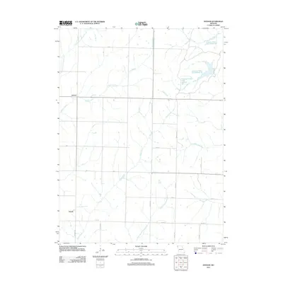
2012 Map of Dotham
USGS Topo · Published 2012About this map
Dotham and Oswald anchor this rural landscape in Atchison County, Missouri, during the early 21st century. The map reveals a highly structured agricultural grid defined by local routes such as Nodaway Atchison Rd and Burr Oak Rd, alongside county highways. A complex drainage system defines the terrain, with Squaw Creek and its tributary, Middle Branch Squaw Creek, carving through the center of the sheet, while the East Fork Little Tarkio Creek skirts the western edge. A distinctive cluster of man-made water features, including Patterson Farms Lake Section 12, Patterson Farms Lake Section 13, and Patterson Farms Lake Section 23, indicates modern water management or private agricultural developments in the northeastern corner. These family-named features provide a specific window into contemporary land use and ownership in this part of Northwest Missouri.
Find a feature on this map
28 named features on this map. Tap any name to fly to it.
Don’t see what you’re looking for? This feature index may not catch every label — zoom into the map to look around manually.
Map Details
Editions of this 2012 Dotham Map
This is the sole edition of this map. No revisions or reprints were ever made.
Other maps of this area

1920 · Craig
USGS Topo · 1:62,500

1926 · Maitland
USGS Topo · 1:62,500

1939 · Tarkio
USGS Topo · 1:62,500

1939 · Skidmore
USGS Topo · 1:62,500

1940 · Tarkio
USGS Topo · 1:62,500

1941 · Tarkio
USGS Topo · 1:62,500

1941 · Skidmore
USGS Topo · 1:62,500

1942 · Skidmore
USGS Topo · 1:62,500

1955 · Nebraska City
USGS Topo · 1:250,000

1957 · Nebraska City
USGS Topo · 1:250,000