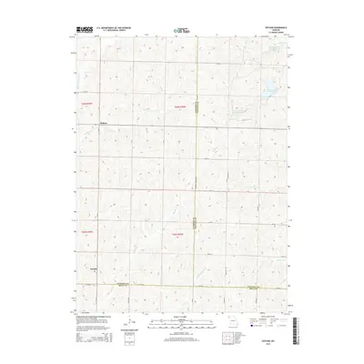
2014 Map of Dotham
USGS Topo · Published 2014About this map
The borderlands of Atchison, Nodaway, and Holt Counties reveal a classic Missouri agricultural landscape defined by a complex network of creeks and drainage branches. Small settlements like Dotham and Oswald anchor the rural infrastructure, while the land is deeply etched by watercourses such as Squaw Cr, Hickory Br, and Huff Cr. The map highlights specialized land use and water management through the series of reservoirs known as Patterson Farms Lake Section 12, Patterson Farms Lake Section 13, and Patterson Farms Lake Section 23. This 2014 survey documents the enduring grid of section-line roads, including Co Line Rd and Key Stone Dr, which have organized this fertile region for generations. The drainage pattern, featuring the E Fork Little Tarkio Cr and Middle Br Squaw Cr, illustrates how local topography dictates the placement of farmsteads and transport routes in this tri-county corner.
Find a feature on this map
37 named features on this map. Tap any name to fly to it.
Don’t see what you’re looking for? This feature index may not catch every label — zoom into the map to look around manually.
Map Details
Editions of this 2014 Dotham Map
This is the sole edition of this map. No revisions or reprints were ever made.
Other maps of this area

1920 · Craig
USGS Topo · 1:62,500

1926 · Maitland
USGS Topo · 1:62,500

1939 · Tarkio
USGS Topo · 1:62,500

1939 · Skidmore
USGS Topo · 1:62,500

1940 · Tarkio
USGS Topo · 1:62,500

1941 · Tarkio
USGS Topo · 1:62,500

1941 · Skidmore
USGS Topo · 1:62,500

1942 · Skidmore
USGS Topo · 1:62,500

1955 · Nebraska City
USGS Topo · 1:250,000

1957 · Nebraska City
USGS Topo · 1:250,000