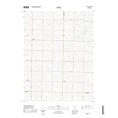
2017 Map of Dotham
USGS Topo · Published 2017About this map
Dotham stands as a primary focal point in this northwestern Missouri landscape where Atchison, Nodaway, and Holt Counties converge. The terrain is defined by a dense network of drainage systems, including Squaw Cr and Middle Br Squaw Cr, which carve through the agricultural uplands. Significant local water management is evident in the series of man-made features such as Patterson Farms Lake Section 12, Patterson Farms Lake Section 13, and Patterson Farms Lake Section 23. These named reservoirs, tied directly to specific section lines, highlight the importance of private land use and water resources in this rural region. The road network, including State Hwy EE and Nodaway Atchison Rd, follows the rigid section-line grid characteristic of the American Midwest, providing access to the varied branches of Hickory Br and Huff Cr.
Find a feature on this map
33 named features on this map. Tap any name to fly to it.
Don’t see what you’re looking for? This feature index may not catch every label — zoom into the map to look around manually.
Map Details
Editions of this 2017 Dotham Map
This is the sole edition of this map. No revisions or reprints were ever made.
Other maps of this area

1920 · Craig
USGS Topo · 1:62,500

1926 · Maitland
USGS Topo · 1:62,500

1939 · Tarkio
USGS Topo · 1:62,500

1939 · Skidmore
USGS Topo · 1:62,500

1940 · Tarkio
USGS Topo · 1:62,500

1941 · Tarkio
USGS Topo · 1:62,500

1941 · Skidmore
USGS Topo · 1:62,500

1942 · Skidmore
USGS Topo · 1:62,500

1955 · Nebraska City
USGS Topo · 1:250,000

1957 · Nebraska City
USGS Topo · 1:250,000