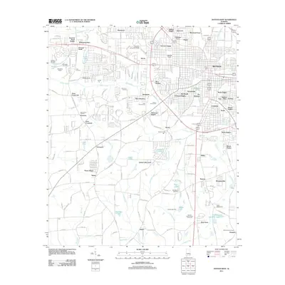
2011 Map of Dothan West
USGS Topo · Published 2011About this map
The western suburbs and rural outskirts of Dothan are captured here during a period of significant residential expansion. Residential developments like Whispering Pines, Sherwood Forest, and Green Acres contrast with older landmarks such as Tabernacle and Jones Crossroads. The landscape is a mix of established neighborhoods and agricultural land, where the National Peanut Festival Fairgrounds serves as a major cultural anchor in the southern portion of the quadrangle.
Find a feature on this map
198 named features on this map. Tap any name to fly to it.
Don’t see what you’re looking for? This feature index may not catch every label — zoom into the map to look around manually.
Map Details
Editions of this 2011 Dothan West Map
This is the sole edition of this map. No revisions or reprints were ever made.
Other maps of this area

1942 · Enterprise
USGS Topo · 1:125,000

1948 · Ozark
USGS Topo · 1:62,500

1950 · Ozark
USGS Topo · 1:62,500

1953 · Dothan
USGS Topo · 1:250,000

1954 · Dothan
USGS Topo · 1:250,000

1955 · Dothan
USGS Topo · 1:250,000

1957 · Malvern
USGS Topo · 1:24,000

1957 · Hartford
USGS Topo · 1:62,500
1957 · Slocomb
USGS Topo · 1:24,000

1960 · Pinckard
USGS Topo · 1:24,000