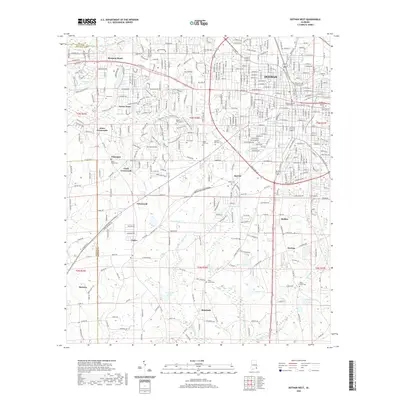
2020 Map of Dothan West
USGS Topo · Published 2020About this map
The western reaches of Dothan and its surrounding communities are documented in this 2020 survey, which highlights the transition from the dense urban grid of the city toward the outlying crossroads and farming settlements. The Houston County Courthouse serves as a central anchor, while the landscape beyond the Ross Clark Cir loop is defined by the winding course of the Little Choctawhatchee River and various tributary creeks. Smaller settlements like Brannon Stand, Green Acres, and Jones Crossroads show the residential expansion into what was once primarily agricultural land.
Find a feature on this map
62 named features on this map. Tap any name to fly to it.
Don’t see what you’re looking for? This feature index may not catch every label — zoom into the map to look around manually.
Map Details
Editions of this 2020 Dothan West Map
This is the sole edition of this map. No revisions or reprints were ever made.
Other maps of this area

1942 · Enterprise
USGS Topo · 1:125,000

1948 · Ozark
USGS Topo · 1:62,500

1950 · Ozark
USGS Topo · 1:62,500

1953 · Dothan
USGS Topo · 1:250,000

1954 · Dothan
USGS Topo · 1:250,000

1955 · Dothan
USGS Topo · 1:250,000

1957 · Malvern
USGS Topo · 1:24,000

1957 · Hartford
USGS Topo · 1:62,500
1957 · Slocomb
USGS Topo · 1:24,000

1960 · Pinckard
USGS Topo · 1:24,000