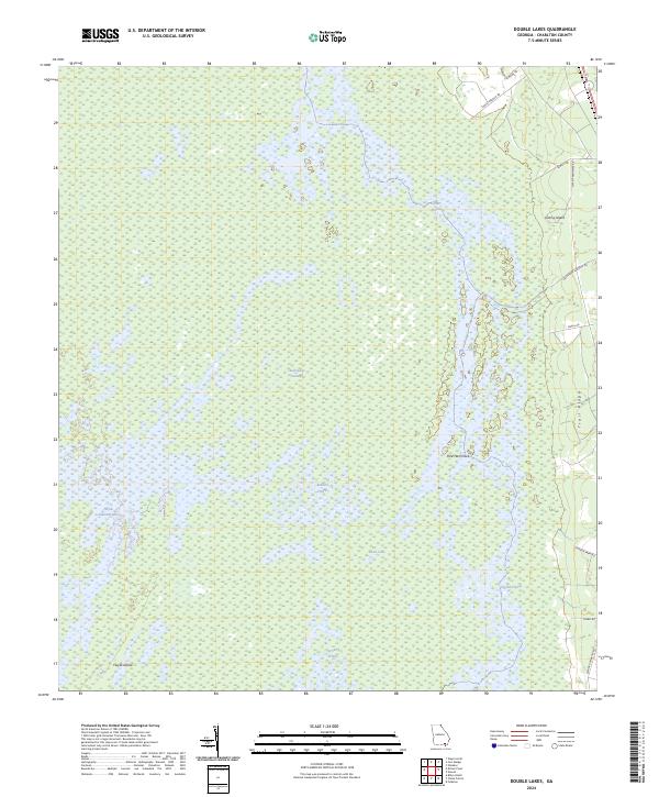
2024 Map of Double Lakes
USGS Topo · Published 2024About this map
The Okefenokee National Wildlife Refuge dominates this section of Charlton County, revealing the intricate water and land patterns of the Okefenokee Wilderness. This environment is defined by an expansive mosaic of open water and aquatic prairies, including Carters Prairie, Redbird Prairie, and Durdin Prairie, which are interspersed with isolated landforms known locally as hammocks and islands. Notable elevations like Floyds Island and Grassy Island rise above the surrounding Okefenokee Swamp, providing critical dry ground within the wetland complex.
Find a feature on this map
20 named features on this map. Tap any name to fly to it.
Don’t see what you’re looking for? This feature index may not catch every label — zoom into the map to look around manually.
Map Details
Editions of this 2024 Double Lakes Map
This is the sole edition of this map. No revisions or reprints were ever made.
Other maps of this area

1918 · Folkston
USGS Topo · 1:62,500

1953 · Waycross
USGS Topo · 1:250,000

1954 · Valdosta
USGS Topo · 1:250,000

1958 · Valdosta
USGS Topo · 1:250,000

1958 · Waycross
USGS Topo · 1:250,000

1959 · Valdosta
USGS Topo · 1:250,000

1965 · Double Lakes
USGS Topo · 1:24,000

1965 · Chase Prairie
USGS Topo · 1:24,000

1965 · Dinner Pond
USGS Topo · 1:24,000
1966 · Billys Island
USGS Topo · 1:24,000