
1967 Map of Double Mill Draw SE
USGS Topo · Published 1970About this map
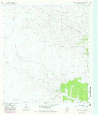
The Devils River basin in Crockett County reveals a rugged landscape defined by its ephemeral drainage networks and emerging resource extraction during the late 1960s. The terrain is characterized by the winding paths of Buckhorn Draw and Turkey Roost Draw, where the intermittent water flow shaped the local ranching and industrial footprint. Clayton Ranch stands as a primary point of human habitation in this isolated stretch of West Texas, surrounded by the physical evidence of early petroleum exploration and material gathering. Multiple Drill Hole locations, an Oil Well, and a Gas Well indicate the period's subsurface investigations. On the surface, numerous Gravel Pits and a prominent Pipeline cutting across the contours highlight the industrial infrastructure required to support the region's mineral interests and transportation needs.
Find a feature on this map
11 named features on this map. Tap any name to fly to it.
Don’t see what you’re looking for? This feature index may not catch every label — zoom into the map to look around manually.
Map Details
Editions of this 1967 Double Mill Draw SE Map
2 editions found
Other maps of this area

1954 · Sonora
USGS Topo · 1:250,000

1958 · Sonora
USGS Topo · 1:250,000

1964 · Oglesby Ranch
USGS Topo · 1:24,000

1964 · Bailey Draw
USGS Topo · 1:24,000

1967 · Nolen Draw
USGS Topo · 1:24,000

1967 · Ozona
USGS Topo · 1:24,000

1967 · Indio Hill
USGS Topo · 1:24,000

1967 · Double Mill Draw NW
USGS Topo · 1:24,000

1967 · Crockett Heights
USGS Topo · 1:24,000
1967 · Double Mill Draw NE
USGS Topo · 1:24,000