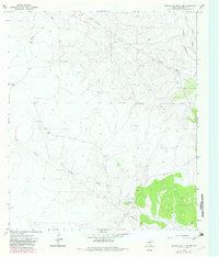
1967 Map of Double Mill Draw SE
USGS Topo · Published 1982About this map
Clayton Ranch stands as a focal point in this portion of the Texas Edwards Plateau, illustrating the large-scale ranching operations typical of Crockett County during the mid-20th century. The landscape is defined by the intermittent drainage of Turkey Roost Draw and the more significant Devils River to the northeast, where the terrain becomes notably more dissected. While livestock agriculture provides the surface character, the map reveals a subterranean industrial layer through scattered Oil Wells, Gas Wells, and a network of pipelines that traverse the limestone hills. This dual-use economy of mineral extraction and traditional ranching is further evidenced by numerous Gravel Pits and various Drill Holes, marking a period of intense exploratory activity in the Permian Basin's southern reaches.
Find a feature on this map
10 named features on this map. Tap any name to fly to it.
Don’t see what you’re looking for? This feature index may not catch every label — zoom into the map to look around manually.
Map Details
Editions of this 1967 Double Mill Draw SE Map
2 editions found
Other maps of this area

1954 · Sonora
USGS Topo · 1:250,000

1958 · Sonora
USGS Topo · 1:250,000

1964 · Oglesby Ranch
USGS Topo · 1:24,000

1964 · Bailey Draw
USGS Topo · 1:24,000

1967 · Nolen Draw
USGS Topo · 1:24,000

1967 · Ozona
USGS Topo · 1:24,000

1967 · Double Mill Draw SE
USGS Topo · 1:24,000

1967 · Indio Hill
USGS Topo · 1:24,000

1967 · Double Mill Draw NW
USGS Topo · 1:24,000

1967 · Crockett Heights
USGS Topo · 1:24,000