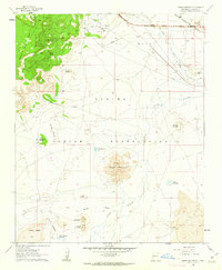
1960 Map of Dough Mountain
USGS Topo · Published 1963About this map
The Laguna Indian Reservation landscape is defined by the stark volcanic geology of the San Jose River valley, where the high mesa of South Point Mesa overlooks the Lava beds and the distinctive Dough Mountain. In the early 1960s, this area supported industrial and transport infrastructure, including the Laguna Compressor Station and the South Laguna Mines tucked beneath the mesa rims. Settlement is sparse, represented by small locales like Mesitá Blanca and Schero Gana, along with isolated outposts like Kase Sheep Camp. The corridor along the Rio San Jose serves as a vital transit artery, carrying the Atchison Topeka and Santa Fe railroad and the burgeoning path of Interstate 40 alongside the older route of Highway 66. This transition from traditional sheep camps to modern interstate and pipeline infrastructure marks a significant era of change for this New Mexico terrain.
Find a feature on this map
34 named features on this map. Tap any name to fly to it.
Don’t see what you’re looking for? This feature index may not catch every label — zoom into the map to look around manually.
Map Details
Editions of this 1960 Dough Mountain Map
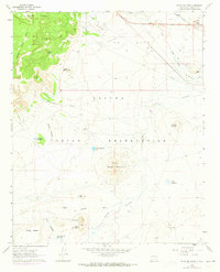
2 editions found
Other maps of this area

1883 · Mt. Taylor
USGS Topo · 1:250,000

1886 · Mt. Taylor
USGS Topo · 1:250,000

1892 · Mt. Taylor
USGS Topo · 1:250,000

1899 · Mt. Taylor
USGS Topo · 1:250,000

1917 · Cerro Verde
USGS Topo · 1:125,000

1954 · Socorro
USGS Topo · 1:250,000

1956 · South Garcia
USGS Topo · 1:62,500

1957 · Laguna
USGS Topo · 1:24,000
1957 · Mesa Gigante
USGS Topo · 1:24,000

1957 · Mesita
USGS Topo · 1:24,000