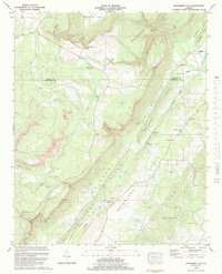
1983 Map of Dougherty Gap
USGS Topo · Published 1984About this map
Shinbone Ridge and Pigeon Mountain define the topography of this corner of northwest Georgia, creating a sequence of isolated valleys where small farming and residential communities like Teloga and Harrisburg took root. The 1983 map shows a landscape structured by these parallel ridges, with gaps such as Neal Gap and Chelsea Gap serving as essential transit points between the Shinbone Valley and the Broomtown Valley. Along the southern edge of the sheet, the girl scout camp Camp Juliet Low is situated near the community of Cloudland, overlooking the dramatic drop of Billygoat Bluff. Genealogists will find a wealth of local landmarks including the Beersheba Ch, Macedonia Ch, and family burial sites like Garrett Cem and Hemphill Cem, which reflect the area's deep-seated rural character before modern development patterns fully took hold.
Find a feature on this map
64 named features on this map. Tap any name to fly to it.
Don’t see what you’re looking for? This feature index may not catch every label — zoom into the map to look around manually.
Map Details
Editions of this 1983 Dougherty Gap Map
This is the sole edition of this map. No revisions or reprints were ever made.
Other maps of this area

1886 · Ringgold
USGS Topo · 1:125,000

1886 · Rome
USGS Topo · 1:125,000

1886 · Stevenson
USGS Topo · 1:125,000

1892 · Ringgold
USGS Topo · 1:125,000

1892 · Stevenson
USGS Topo · 1:125,000

1893 · Fort Payne
USGS Topo · 1:125,000

1895 · Stevenson
USGS Topo · 1:125,000

1898 · Rome
USGS Topo · 1:125,000

1898 · Fort Payne
USGS Topo · 1:125,000

1899 · Rome
USGS Topo · 1:125,000