
1955 Map of Douglas
USGS Topo · Published 1955About this map
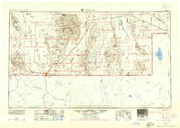
The Chiricahua Mountains and the mining-rich Mule Mountains dominate this mid-century look at the Arizona-New Mexico borderlands. Centered on the international gateway of Douglas, the map details a landscape transitioning from isolated mining camps to established regional hubs. The copper legacy is evident in the cluster of Bisbee, Warren, and Lowell, while the Southern Pacific railroad and a network of smaller tracks connect ranching outposts across the Sulphur Spring Valley and Animas Valley. Local education and infrastructure are noted through the Double Adobe School and the Bisbee-Douglas Intl airport. Across the border in Sonora and Chihuahua, the map tracks the southern reaches of the Sierra de San Bernardino and the drainage of the Río de Agua Prieta, providing a rare cross-border view of this high desert environment.
Find a feature on this map
115 named features on this map. Tap any name to fly to it.
Don’t see what you’re looking for? This feature index may not catch every label — zoom into the map to look around manually.
Map Details
Editions of this 1955 Douglas Map
2 editions found
Other maps of this area

1899 · Deming
USGS Topo · 1:125,000

1902 · Bisbee
USGS Topo · 1:62,500

1910 · Bisbee
USGS Topo · 1:62,500

1914 · Hereford
USGS Topo · 1:125,000

1914 · Douglas
USGS Topo · 1:62,500

1915 · Benson
USGS Topo · 1:125,000

1915 · Deming
USGS Topo · 1:125,000

1916 · Pearce
USGS Topo · 1:125,000

1916 · Douglas
USGS Topo · 1:125,000

1917 · Hermanas
USGS Topo · 1:62,500