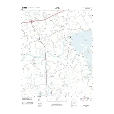
2010 Map of Douglas Dam
USGS Topo · Published 2010About this map
The French Broad River and Little Pigeon River converge in this Tennessee landscape, dominated by the massive infrastructure of Douglas Dam and its reservoir. The 2010 topography shows the complex system of secondary embankments, including Saddle Dam 1 through Saddle Dam 10, which contain the waters of Douglas Lake as it fills the deep valleys of the Great Smoky Mountains foothills. This period of the county's history is marked by a blend of lakeside recreation at Douglas Dock and deep-rooted rural heritage evidenced by more than a dozen family burying grounds such as Henrys Crossroads Cemetery and Alder Branch Cemetery.
Find a feature on this map
119 named features on this map. Tap any name to fly to it.
Don’t see what you’re looking for? This feature index may not catch every label — zoom into the map to look around manually.
Map Details
Editions of this 2010 Douglas Dam Map
This is the sole edition of this map. No revisions or reprints were ever made.
Other maps of this area

1883 · Morristown
USGS Topo · 1:125,000

1886 · Knoxville
USGS Topo · 1:125,000

1892 · Knoxville
USGS Topo · 1:125,000

1893 · Mt Guyot
USGS Topo · 1:125,000

1893 · Morristown
USGS Topo · 1:125,000

1894 · Knoxville
USGS Topo · 1:125,000

1895 · Morristown
USGS Topo · 1:125,000

1895 · Knoxville
USGS Topo · 1:125,000

1897 · Maynardville
USGS Topo · 1:125,000

1900 · Maynardville
USGS Topo · 1:125,000