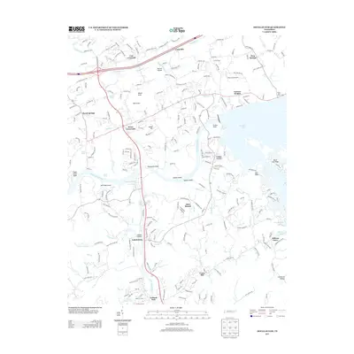
2013 Map of Douglas Dam
USGS Topo · Published 2013About this map
Henry Crossroads and Catlettsburg anchor this topographical survey of Sevier County, where the sprawling waters of Douglas Lake meet the natural course of the French Broad River. The landscape is defined by the convergence of significant water systems, including the Little Pigeon River and numerous creeks like Dumplin Cr and Millican Cr. This era shows a transition from rural crossroads like Cate Crossroad and Cook Mill toward modern infrastructure, with Tenn 66 and I-40 providing major transit corridors through the undulating terrain of Hester Knob and Black Oak Ridge. Genealogists and local historians can trace family-named settlements and landmarks such as Mutton Hollow, Union Hill, and Alder Branch, alongside aviation markers like Ray's Stall Airport. The map detail preserves the intricate shoreline of islands and bluffs, from McCrosky Island to Sheepwalk Bluff.
Find a feature on this map
50 named features on this map. Tap any name to fly to it.
Don’t see what you’re looking for? This feature index may not catch every label — zoom into the map to look around manually.
Map Details
Editions of this 2013 Douglas Dam Map
This is the sole edition of this map. No revisions or reprints were ever made.
Other maps of this area

1883 · Morristown
USGS Topo · 1:125,000

1886 · Knoxville
USGS Topo · 1:125,000

1892 · Knoxville
USGS Topo · 1:125,000

1893 · Mt Guyot
USGS Topo · 1:125,000

1893 · Morristown
USGS Topo · 1:125,000

1894 · Knoxville
USGS Topo · 1:125,000

1895 · Morristown
USGS Topo · 1:125,000

1895 · Knoxville
USGS Topo · 1:125,000

1897 · Maynardville
USGS Topo · 1:125,000

1900 · Maynardville
USGS Topo · 1:125,000