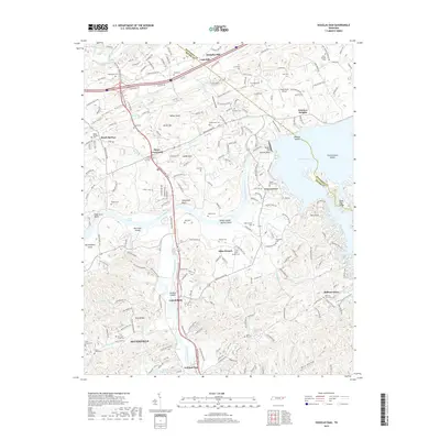
2019 Map of Douglas Dam
USGS Topo · Published 2019About this map
Douglas Lake dominates the eastern landscape where the French Broad River meets several significant tributaries, including the Little Pigeon River and Millican Cr. This modern survey illustrates the complex intersection of early pioneer settlements and major regional transit, with Interstate 40 and the Winfield Dunn Pkwy cutting through historic terrain. The map is particularly rich in genealogical data, preserving the locations of numerous family and community burial grounds such as the Oak Grove Cem, Atchley Cem, and the Old Gists Creek Cem near the northern edge of Sevierville. Along the riverbanks, distinctive landforms like Eight Acre Bluff and islands such as McCrosky Island and Saffell Island mark the original river channel. The document also highlights small, enduring communities like Henry Crossroads and Cook Mill, providing a detailed look at how these local centers have integrated with contemporary developments like Rays Stall Airport and Yettland Park.
Find a feature on this map
68 named features on this map. Tap any name to fly to it.
Don’t see what you’re looking for? This feature index may not catch every label — zoom into the map to look around manually.
Map Details
Editions of this 2019 Douglas Dam Map
This is the sole edition of this map. No revisions or reprints were ever made.
Other maps of this area

1883 · Morristown
USGS Topo · 1:125,000

1886 · Knoxville
USGS Topo · 1:125,000

1892 · Knoxville
USGS Topo · 1:125,000

1893 · Mt Guyot
USGS Topo · 1:125,000

1893 · Morristown
USGS Topo · 1:125,000

1894 · Knoxville
USGS Topo · 1:125,000

1895 · Morristown
USGS Topo · 1:125,000

1895 · Knoxville
USGS Topo · 1:125,000

1897 · Maynardville
USGS Topo · 1:125,000

1900 · Maynardville
USGS Topo · 1:125,000