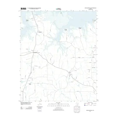
2013 Map of Douglassville
USGS Topo · Published 2013About this map
Wright Patman Lake dominates the northern reaches of this Cass County landscape, where the shoreline is punctuated by local access points like Overcup Landing, Poorboy Landing, and Armstrong Landing. The interior reflects a predominantly rural settlement pattern, anchored by the town of Douglassville and smaller communities such as Gum Springs, Antioch, and New Liberty. These hamlets are connected by a network of county roads and farm-to-market routes that navigate the creek valleys of Carlow Cr and Johns Cr. Genealogists may find value in the locations of Liberty Cem and Rutland Cem, while the inclusion of the Douglassville Lookout and Knights Bluff suggests the topographic variance typical of the Piney Woods. This 2013 survey provides a detailed view of the regional geography before modern developments might have altered these established rural footprints.
Find a feature on this map
82 named features on this map. Tap any name to fly to it.
Don’t see what you’re looking for? This feature index may not catch every label — zoom into the map to look around manually.
Map Details
Editions of this 2013 Douglassville Map
This is the sole edition of this map. No revisions or reprints were ever made.
Other maps of this area

1907 · Atlanta
USGS Topo · 1:62,500

1909 · New Boston
USGS Topo · 1:62,500

1909 · Texarkana
USGS Topo · 1:62,500

1910 · Linden
USGS Topo · 1:62,500

1910 · Atlanta
USGS Topo · 1:62,500

1953 · Texarkana
USGS Topo · 1:250,000

1954 · Lake Texarkana
USGS Topo · 1:24,000
1954 · Texarkana
USGS Topo · 1:62,500

1955 · Corley
USGS Topo · 1:24,000

1955 · Maud
USGS Topo · 1:24,000