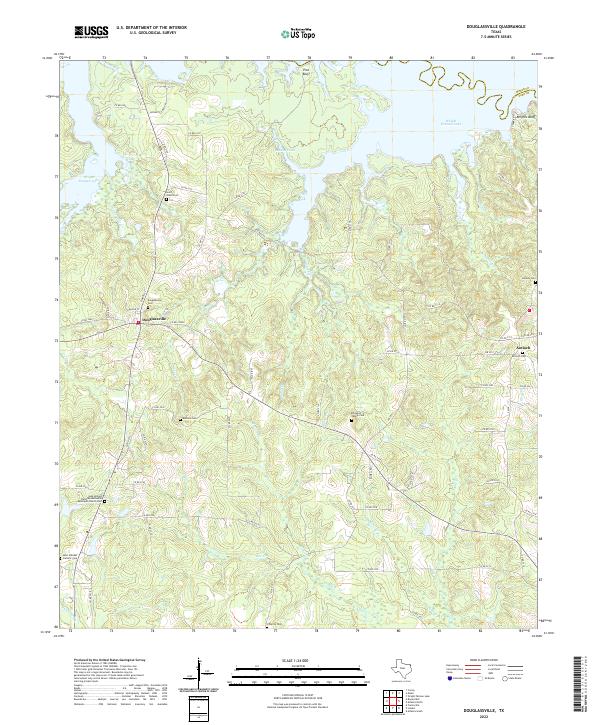
2022 Map of Douglassville
USGS Topo · Published 2022About this map
Douglassville and the surrounding Cass County landscape are defined by the intricate creek systems feeding into the southern reaches of Wright Patman Lake. The terrain is marked by numerous family burial sites and rural congregations, reflecting a deeply rooted settlement pattern typical of East Texas. Notable landmarks such as Pine Bluff and Knights Bluff overlook the water, while the interior is crisscrossed by namesake waterways like Douglassville Cr, Ballard Creek, and Bee Cr. Genealogy interests are well-served by the inclusion of several distinct cemeteries, including the Saint Johns Cem, Rutland Cem, and the Ellington Family Cem. Farther south, the community of Antioch and the Gum Springs Christian Methodist Episcopal Church Cem point to established social hubs connected by a network of farm-to-market roads and county routes that navigate the wooded divides between the many branches and creeks.
Find a feature on this map
78 named features on this map. Tap any name to fly to it.
Don’t see what you’re looking for? This feature index may not catch every label — zoom into the map to look around manually.
Map Details
Editions of this 2022 Douglassville Map
This is the sole edition of this map. No revisions or reprints were ever made.
Other maps of this area

1907 · Atlanta
USGS Topo · 1:62,500

1909 · New Boston
USGS Topo · 1:62,500

1909 · Texarkana
USGS Topo · 1:62,500

1910 · Linden
USGS Topo · 1:62,500

1910 · Atlanta
USGS Topo · 1:62,500

1953 · Texarkana
USGS Topo · 1:250,000

1954 · Lake Texarkana
USGS Topo · 1:24,000
1954 · Texarkana
USGS Topo · 1:62,500

1955 · Corley
USGS Topo · 1:24,000

1955 · Maud
USGS Topo · 1:24,000