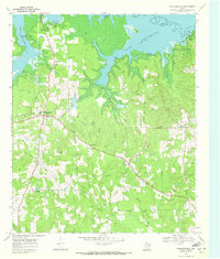
1969 Map of Douglassville
USGS Topo · Published 1972About this map
Douglassville sits at the heart of this East Texas landscape, serving as a hub where local roads converge near Webster Creek. In the late 1960s, the northern edge of the quadrangle is dominated by the sprawling waters of Lake Texarkana and the Sulphur River, which define the boundary between Bowie and Cass counties. The shoreline is marked by recreation and early park development, including Atlanta State Park and various landings like Poorboy Landing and Knights Bluff Landing.
Find a feature on this map
46 named features on this map. Tap any name to fly to it.
Don’t see what you’re looking for? This feature index may not catch every label — zoom into the map to look around manually.
Map Details
Editions of this 1969 Douglassville Map
This is the sole edition of this map. No revisions or reprints were ever made.
Other maps of this area

1907 · Atlanta
USGS Topo · 1:62,500

1909 · New Boston
USGS Topo · 1:62,500

1909 · Texarkana
USGS Topo · 1:62,500

1910 · Linden
USGS Topo · 1:62,500

1910 · Atlanta
USGS Topo · 1:62,500

1953 · Texarkana
USGS Topo · 1:250,000

1954 · Lake Texarkana
USGS Topo · 1:24,000
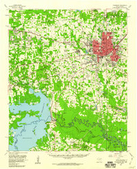
1954 · Texarkana
USGS Topo · 1:62,500

1955 · Corley
USGS Topo · 1:24,000

1955 · Maud
USGS Topo · 1:24,000