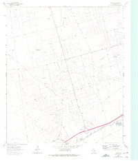
1964 Map of Douro
USGS Topo · Published 1975About this map
Industrial infrastructure and ranching history converge in this mid-century survey of the West Texas landscape. The Texas and Pacific railroad tracks and several major oil fields, including the Lawson Oil Field and Donnelly Oil Field, define the region's economy during this period of expansion. Evidence of the area's older pastoral roots remains at the Old Buchanan Ranch (Headquarters), providing a contrast to the dense network of pipelines and service roads that crisscross the terrain.
Find a feature on this map
13 named features on this map. Tap any name to fly to it.
Don’t see what you’re looking for? This feature index may not catch every label — zoom into the map to look around manually.
Map Details
Editions of this 1964 Douro Map
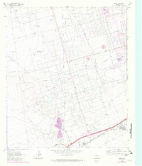
Other maps of this area

1954 · Pecos
USGS Topo · 1:250,000

1957 · Pecos
USGS Topo · 1:250,000

1964 · Odessa SW
USGS Topo · 1:24,000

1964 · Odessa NW
USGS Topo · 1:24,000

1964 · Turnbaugh Corner
USGS Topo · 1:24,000

1964 · Douro
USGS Topo · 1:24,000

1964 · Metz
USGS Topo · 1:24,000

1964 · Red Lakes
USGS Topo · 1:24,000

1964 · Penwell
USGS Topo · 1:24,000

1964 · Clark Brothers Ranch
USGS Topo · 1:24,000