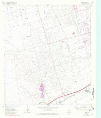
1964 Map of Douro
USGS Topo · Published 1981About this map
Oil and gas infrastructure dominates this West Texas landscape during the early 1960s, with later updates through the late 1970s. The region is defined by extensive energy production zones including the Lawson Oil Field, Donnelly Oil Field, and Harper Field. These industrial operations are supported by a dense network of pipelines and service roads, alongside a dedicated Landing Strip and the Radio Tower (KOSA).
Find a feature on this map
19 named features on this map. Tap any name to fly to it.
Don’t see what you’re looking for? This feature index may not catch every label — zoom into the map to look around manually.
Map Details
Editions of this 1964 Douro Map
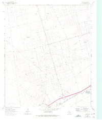
Other maps of this area

1954 · Pecos
USGS Topo · 1:250,000

1957 · Pecos
USGS Topo · 1:250,000

1964 · Odessa SW
USGS Topo · 1:24,000

1964 · Odessa NW
USGS Topo · 1:24,000

1964 · Turnbaugh Corner
USGS Topo · 1:24,000

1964 · Douro
USGS Topo · 1:24,000

1964 · Metz
USGS Topo · 1:24,000

1964 · Red Lakes
USGS Topo · 1:24,000

1964 · Penwell
USGS Topo · 1:24,000

1964 · Clark Brothers Ranch
USGS Topo · 1:24,000