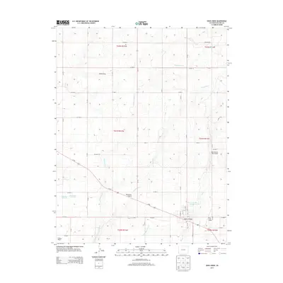
2013 Map of Dove Creek
USGS Topo · Published 2013About this map
Dove Creek serves as the primary hub in this corner of Dolores County, where the high plateau landscape is carved by deep drainages and intermittent watercourses. The town's grid, including Main St and Guyrene St, is situated near the Dove Creek Airport, reflecting its role as a regional center. To the west, the terrain drops away into Monument Canyon and the winding path of Monument Cr, while smaller agricultural developments are marked by water management features such as Ducks Nest Reservoir and Dove Cr Number 1 Reservoir. The surrounding landscape is defined by a dense network of county roads—like Co Road A and Co Road J—that navigate the plateau between prominent natural landmarks including Wilson Draw and the West Branch Big Canyon. This 2013 survey illustrates how transportation and water storage remain central to life on the Colorado plateau, anchored by the settlement at Cedar Point.
Find a feature on this map
44 named features on this map. Tap any name to fly to it.
Don’t see what you’re looking for? This feature index may not catch every label — zoom into the map to look around manually.
Map Details
Editions of this 2013 Dove Creek Map
This is the sole edition of this map. No revisions or reprints were ever made.
Other maps of this area

1886 · Abajo
USGS Topo · 1:250,000

1892 · Abajo
USGS Topo · 1:250,000

1893 · Abajo
USGS Topo · 1:250,000

1949 · Egnar
USGS Topo · 1:24,000

1949 · Joe Davis Hill
USGS Topo · 1:24,000

1950 · Joe Davis Hill
USGS Topo · 1:24,000

1950 · Egnar
USGS Topo · 1:24,000

1956 · Cortez
USGS Topo · 1:250,000

1957 · Cedar 3 NW
USGS Topo · 1:24,000

1957 · Monument Canyon
USGS Topo · 1:62,500