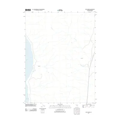
2011 Map of Dove Creek
USGS Topo · Published 2011About this map
Pyramid Lake defines the western edge of this Washoe County landscape, where the shoreline gives way to the notable indent of Artillery Bay. Moving inland, the terrain is shaped by the drainage patterns of Dove Creek, which flows through the eastern portion of the quadrangle. This 2011 survey illustrates a sparse desert environment characterized by significant landforms such as Big Basin and the prominence of Allen Hill. Water sources are few in this arid region, making landmarks like Sevenmile Spring critical points of interest. The map documents the high-desert character of Nevada just after the turn of the 21st century, showing a landscape defined more by its natural hydrography and topography than by dense human settlement.
Find a feature on this map
6 named features on this map. Tap any name to fly to it.
Don’t see what you’re looking for? This feature index may not catch every label — zoom into the map to look around manually.
Map Details
Editions of this 2011 Dove Creek Map
This is the sole edition of this map. No revisions or reprints were ever made.
Other maps of this area

1886 · Granite Range
USGS Topo · 1:250,000

1890 · Wadsworth
USGS Topo · 1:125,000

1891 · Reno
USGS Topo · 1:125,000

1892 · Wadsworth
USGS Topo · 1:125,000

1893 · Reno
USGS Topo · 1:125,000

1894 · Granite Range
USGS Topo · 1:250,000

1894 · Wadsworth
USGS Topo · 1:125,000

1955 · Lovelock
USGS Topo · 1:250,000

1957 · Sutcliffe
USGS Topo · 1:62,500

1957 · Nixon
USGS Topo · 1:62,500