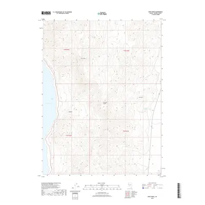
2018 Map of Dove Creek
USGS Topo · Published 2018About this map
Pyramid Lake defines the western edge of this High Desert landscape, where the waters of Artillery Bay meet the steep slopes of the Lake Range. This 2018 survey documents a largely unpopulated area of Washoe County, characterized by significant elevation changes and seasonal water sources. The terrain is marked by deep geographic depressions and isolated rises, most notably Big Basin and the prominent Allen Hill to the east. Water, though scarce, is traced through the winding path of Dove Cr and the location of Sevenmile Spring, which sits at the head of Sevenmile Canyon. The map provides a clear record of the Public Land Survey System grid, including townships t26n r23e and t25n r22e, which are essential for property research and land management in this arid corridor.
Find a feature on this map
12 named features on this map. Tap any name to fly to it.
Don’t see what you’re looking for? This feature index may not catch every label — zoom into the map to look around manually.
Map Details
Editions of this 2018 Dove Creek Map
This is the sole edition of this map. No revisions or reprints were ever made.
Other maps of this area

1886 · Granite Range
USGS Topo · 1:250,000

1890 · Wadsworth
USGS Topo · 1:125,000

1891 · Reno
USGS Topo · 1:125,000

1892 · Wadsworth
USGS Topo · 1:125,000

1893 · Reno
USGS Topo · 1:125,000

1894 · Granite Range
USGS Topo · 1:250,000

1894 · Wadsworth
USGS Topo · 1:125,000

1955 · Lovelock
USGS Topo · 1:250,000

1957 · Sutcliffe
USGS Topo · 1:62,500

1957 · Nixon
USGS Topo · 1:62,500