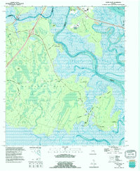
1993 Map of Dover Bluff
USGS Topo · Published 1995About this map
Satilla River hydrology and the coastal marshes of Camden and Glynn counties dominate this mid-1990s survey. The landscape is defined by its labyrinthine waterways, including Maiden Creek, Dover Creek, and Umbrella Creek, which carve through low-lying islands like Colonels Island and Jointer Island. Cultural history is preserved through scattered community markers such as Mt Sinai Ch and several family burial grounds including Hull Cem and Whitehead Cem. Notably, the map identifies the Ruins of Old Spanish Mission near Umbrella Point, providing a direct link to the colonial-era history of the Georgia coast. The transition from established river settlements like Dover Bluff to the expansive Hazardous Swamp illustrates the environmental complexity of the Atlantic Intracoastal waterway region before more recent coastal development intensified.
Find a feature on this map
47 named features on this map. Tap any name to fly to it.
Don’t see what you’re looking for? This feature index may not catch every label — zoom into the map to look around manually.
Map Details
Editions of this 1993 Dover Bluff Map
This is the sole edition of this map. No revisions or reprints were ever made.
Other maps of this area

1918 · Cumberland Island
USGS Topo · 1:62,500

1918 · Bladen
USGS Topo · 1:62,500

1918 · Kingsland
USGS Topo · 1:62,500

1930 · Cumberland Island
USGS Topo · 1:62,500

1939 · Bladen
USGS Topo · 1:62,500

1945 · Brunswick
USGS Topo · 1:62,500

1945 · Cumberland Island
USGS Topo · 1:62,500

1946 · Brunswick
USGS Topo · 1:250,000

1948 · Jacksonville
USGS Topo · 1:250,000

1948 · Brunswick
USGS Topo · 1:250,000