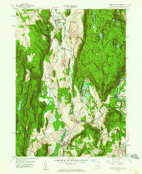
1958 Map of Dover Plains
USGS Topo · Published 1960About this map
The Tenmile River and the New York Central railroad corridor define the valley floor of this mid-century survey, linking the villages of Dover Plains and Wingdale. The landscape is dominated by industrial and institutional footprints, most notably the expansive grounds of the Harlem Valley State Hospital and the site at Dover Furnace. To the east, the terrain rises sharply toward the Connecticut border, where the Appalachian Trail traverses the ridges above the Housatonic River and the Schaghticoke Indian Reservation. Local history is preserved in the placement of the Valley View Cem and the natural cavern formation known as The Stone Church. Smaller hamlets like Oniontown, South Dover, and Webatuck are interspersed among the ridges and wetlands, including the broad Tamarack Swamp.
Find a feature on this map
70 named features on this map. Tap any name to fly to it.
Don’t see what you’re looking for? This feature index may not catch every label — zoom into the map to look around manually.
Map Details
Editions of this 1958 Dover Plains Map
4 editions found
Other maps of this area

1892 · Cornwall
USGS Topo · 1:62,500

1892 · New Milford
USGS Topo · 1:62,500

1893 · New Milford
USGS Topo · 1:62,500

1893 · Cornwall
USGS Topo · 1:62,500

1893 · Clove
USGS Topo · 1:62,500

1894 · Clove
USGS Topo · 1:62,500

1898 · Clove
USGS Topo · 1:62,500

1899 · Millbrook
USGS Topo · 1:62,500

1901 · Clove
USGS Topo · 1:62,500

1902 · Millbrook
USGS Topo · 1:62,500