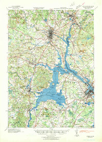
1941 Map of Dover
USGS Topo · Published 1941About this map
The Piscataqua River and Great Bay anchor this 1941 tactical survey, detailing the vital coastal and riverine corridors of southeastern New Hampshire and southwestern Maine just as World War II began. The complex estuarine system is defined by numerous points and islands, including Dover Point, Adams Pt, and Footman I, while the inland landscape is characterized by its reliance on the Boston and Maine RR and the Cocheco River. In Durham, the grounds of the State College appear alongside the town's early residential layout.
Find a feature on this map
143 named features on this map. Tap any name to fly to it.
Don’t see what you’re looking for? This feature index may not catch every label — zoom into the map to look around manually.
Map Details
Editions of this 1941 Dover Map
This is the sole edition of this map. No revisions or reprints were ever made.
Other maps of this area

1888 · Newburyport
USGS Topo · 1:62,500

1888 · Haverhill
USGS Topo · 1:62,500

1890 · Haverhill
USGS Topo · 1:62,500

1890 · Newburyport
USGS Topo · 1:62,500

1891 · Berwick
USGS Topo · 1:62,500

1891 · Kennebunk
USGS Topo · 1:62,500

1893 · Kennebunk
USGS Topo · 1:62,500

1893 · Dover
USGS Topo · 1:62,500

1893 · Berwick
USGS Topo · 1:62,500

1893 · York
USGS Topo · 1:62,500