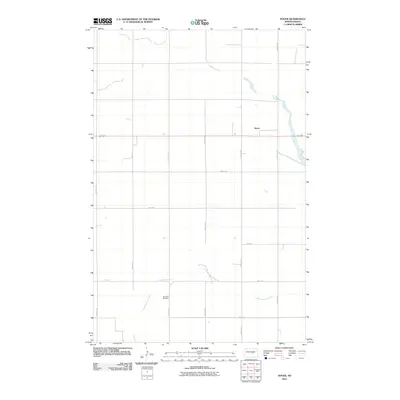
2011 Map of Dover
USGS Topo · Published 2011About this map
Pipestem Creek and its tributary, Little Pipestem Creek, meander across this section of Wells County, shaping the agricultural layout of the northern Great Plains. The small settlement of Dover sits along the northern reach of the waterways, served by a structured grid of rural roads such as 59th Ave NE and Main St. This survey reflects the enduring rural character of the region in the early 21st century, where land use is dictated by the drainage of these creek systems. Genealogists and local historians will find the Brethren Cemetery situated in the southern portion of the quadrangle, a significant landmark for tracing family roots in this farming community. The map preserves the exact alignment of section-line roads, including 1st St SE and 57th Ave SE, which define the administrative and physical boundaries of the local landscape.
Find a feature on this map
21 named features on this map. Tap any name to fly to it.
Don’t see what you’re looking for? This feature index may not catch every label — zoom into the map to look around manually.
Map Details
Editions of this 2011 Dover Map
This is the sole edition of this map. No revisions or reprints were ever made.
Other maps of this area

1948 · New Rockford
USGS Topo · 1:62,500

1948 · Cathay
USGS Topo · 1:62,500

1948 · Carrington
USGS Topo · 1:62,500

1949 · Cathay
USGS Topo · 1:24,000

1949 · Cathay SE
USGS Topo · 1:24,000

1950 · Barlow
USGS Topo · 1:24,000

1950 · Carrington SW
USGS Topo · 1:24,000

1950 · Carrington West
USGS Topo · 1:24,000

1951 · Dover
USGS Topo · 1:24,000

1951 · Sykeston
USGS Topo · 1:24,000