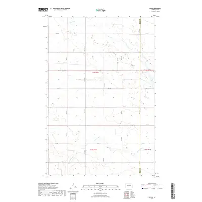
2018 Map of Dover
USGS Topo · Published 2018About this map
Pipestem Cr and its southern tributary, Little Pipestem Cr, meander across this section of central North Dakota, defining the drainage of an agricultural landscape patterned by a strict grid of section-line roads. The small settlement of Dover is situated along the boundary between Wells and Foster counties, serving as a quiet focal point for the surrounding farmsteads. Genealogical interest centers on the Brethren Cem, a localized landmark located south of the main Pipestem fork. This 2018 survey illustrates the persistent rural character of the Great Plains, where long-established townships like t146n r68w and t145n r68w maintain their historic 19th-century land-office proportions alongside modern county roads such as 57th Ave NE and 3rd St NE.
Find a feature on this map
30 named features on this map. Tap any name to fly to it.
Don’t see what you’re looking for? This feature index may not catch every label — zoom into the map to look around manually.
Map Details
Editions of this 2018 Dover Map
This is the sole edition of this map. No revisions or reprints were ever made.
Other maps of this area

1948 · New Rockford
USGS Topo · 1:62,500

1948 · Cathay
USGS Topo · 1:62,500

1948 · Carrington
USGS Topo · 1:62,500

1949 · Cathay
USGS Topo · 1:24,000

1949 · Cathay SE
USGS Topo · 1:24,000

1950 · Barlow
USGS Topo · 1:24,000

1950 · Carrington SW
USGS Topo · 1:24,000

1950 · Carrington West
USGS Topo · 1:24,000

1951 · Dover
USGS Topo · 1:24,000

1951 · Sykeston
USGS Topo · 1:24,000