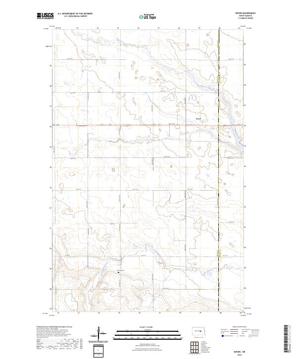
2024 Map of Dover
USGS Topo · Published 2024About this map
Dover occupies a quiet position in the northern reaches of the Great Plains, where the landscape is defined by the meandering courses of Pipestem Creek and Little Pipestem Creek. This 2024 survey captures the agrarian grid of central North Dakota at the border of Wells and Foster counties. The terrain is characterized by prairie wetlands and subtle drainage patterns that feed into the Pipestem valley, with the small settlement of Dover serving as a local focal point along the primary east-west corridor of 3rd St NE. Local history and genealogy are anchored by the Brethren Cem, located south of the main settlement along 57th Ave SE. The map meticulously documents the township and range system, showing the precise divisions of T146N and T145N across the R68W and R67W lines, providing a clear record of the modern rural infrastructure.
Find a feature on this map
29 named features on this map. Tap any name to fly to it.
Don’t see what you’re looking for? This feature index may not catch every label — zoom into the map to look around manually.
Map Details
Editions of this 2024 Dover Map
This is the sole edition of this map. No revisions or reprints were ever made.
Other maps of this area

1948 · New Rockford
USGS Topo · 1:62,500

1948 · Cathay
USGS Topo · 1:62,500

1948 · Carrington
USGS Topo · 1:62,500

1949 · Cathay
USGS Topo · 1:24,000

1949 · Cathay SE
USGS Topo · 1:24,000

1950 · Barlow
USGS Topo · 1:24,000

1950 · Carrington SW
USGS Topo · 1:24,000

1950 · Carrington West
USGS Topo · 1:24,000

1951 · Dover
USGS Topo · 1:24,000

1951 · Sykeston
USGS Topo · 1:24,000