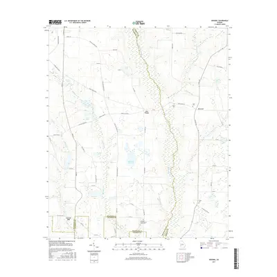
2017 Map of Doverel
USGS Topo · Published 2017About this map
Chickasawhatchee Creek meanders along the Randolph and Terrell County border, defining the eastern edge of a landscape characterized by agricultural tracts and scattered wetlands. Small settlements like Doverel and Five Points serve as local anchors in this rural corner of Southwest Georgia. The topography is dotted with numerous water bodies, ranging from the sizeable Hundred Acre Pond and Rice Lake to the more isolated Wall Lake and Bentley Lake. Evidence of local heritage and family history is preserved at sites such as Aycock Mill and several community burial grounds, including the Bethlehem Freewill Baptist Church Cem. The road network, featuring names like Settle Store Rd and Shellman Cordrays Mi, reflects the enduring layout of rural Georgia as it appeared in the late 2010s.
Find a feature on this map
54 named features on this map. Tap any name to fly to it.
Don’t see what you’re looking for? This feature index may not catch every label — zoom into the map to look around manually.
Map Details
Editions of this 2017 Doverel Map
This is the sole edition of this map. No revisions or reprints were ever made.
Other maps of this area

1953 · Dothan
USGS Topo · 1:250,000

1954 · Dothan
USGS Topo · 1:250,000

1955 · Dothan
USGS Topo · 1:250,000

1956 · Sasser
USGS Topo · 1:62,500

1972 · Shellman
USGS Topo · 1:24,000
1972 · Brooksville
USGS Topo · 1:24,000

1973 · Morgan
USGS Topo · 1:24,000

1973 · Chickasawhatchee
USGS Topo · 1:24,000

1973 · Martins Crossroads
USGS Topo · 1:24,000

1973 · Dawson
USGS Topo · 1:24,000