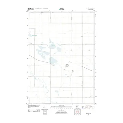
2010 Map of Dovray
USGS Topo · Published 2010About this map
The village of Dovray anchors this Murray County landscape, centered at the intersection of 141st St and 250th Ave. This corner of southwestern Minnesota is defined by its transition from prairie wetlands to agricultural grid, with notable water bodies like Buffalo Lake and the meandering Devils Run cutting through the section lines. Local history is preserved in several rural burial grounds, including Willow Lake Cemetery in the north and the Old German Cemetery near the town center.
Find a feature on this map
36 named features on this map. Tap any name to fly to it.
Don’t see what you’re looking for? This feature index may not catch every label — zoom into the map to look around manually.
Map Details
Editions of this 2010 Dovray Map
This is the sole edition of this map. No revisions or reprints were ever made.
Other maps of this area

1953 · New Ulm
USGS Topo · 1:250,000

1954 · Fairmont
USGS Topo · 1:250,000

1957 · New Ulm
USGS Topo · 1:250,000

1958 · New Ulm
USGS Topo · 1:250,000

1958 · Fairmont
USGS Topo · 1:250,000

1967 · New Ulm
USGS Topo · 1:250,000

1967 · Walnut Grove
USGS Topo · 1:24,000

1967 · Tracy East
USGS Topo · 1:24,000
1967 · Tracy West
USGS Topo · 1:24,000

1967 · Dovray
USGS Topo · 1:24,000