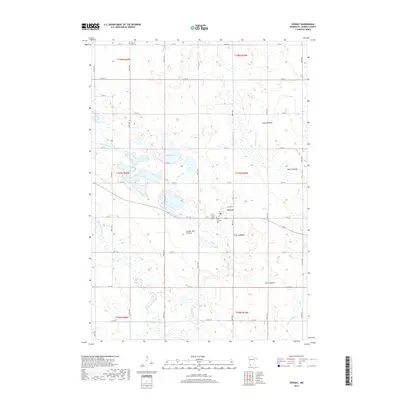
2019 Map of Dovray
USGS Topo · Published 2019About this map
The small town of Dovray sits atop the notable Coteau des Prairies, a high glacial plateau that defines the drainage patterns of Murray County. This 2019 survey captures a landscape where water and heritage intersect, evidenced by the numerous local burial sites including Old German Cem, Our Saviors Cem, and Willow Lake Cem. The terrain is characterized by a series of lakebeds and active water bodies, such as Buffalo Lake and Willow Lake, which feed into local systems like Willow Cr and the Des Moines River. Notable for hydrologists and historians alike, the map identifies several distinct former water bodies such as Duck Lakebed, Rush Lakebed, and Star Lakebed, illustrating the evolution of the local prairie environment. A complex network of drainage, including County Ditch Number Four, underscores the agricultural management of this high-ground region.
Find a feature on this map
45 named features on this map. Tap any name to fly to it.
Don’t see what you’re looking for? This feature index may not catch every label — zoom into the map to look around manually.
Map Details
Editions of this 2019 Dovray Map
This is the sole edition of this map. No revisions or reprints were ever made.
Other maps of this area

1953 · New Ulm
USGS Topo · 1:250,000

1954 · Fairmont
USGS Topo · 1:250,000

1957 · New Ulm
USGS Topo · 1:250,000

1958 · New Ulm
USGS Topo · 1:250,000

1958 · Fairmont
USGS Topo · 1:250,000

1967 · New Ulm
USGS Topo · 1:250,000

1967 · Walnut Grove
USGS Topo · 1:24,000

1967 · Tracy East
USGS Topo · 1:24,000
1967 · Tracy West
USGS Topo · 1:24,000

1967 · Dovray
USGS Topo · 1:24,000