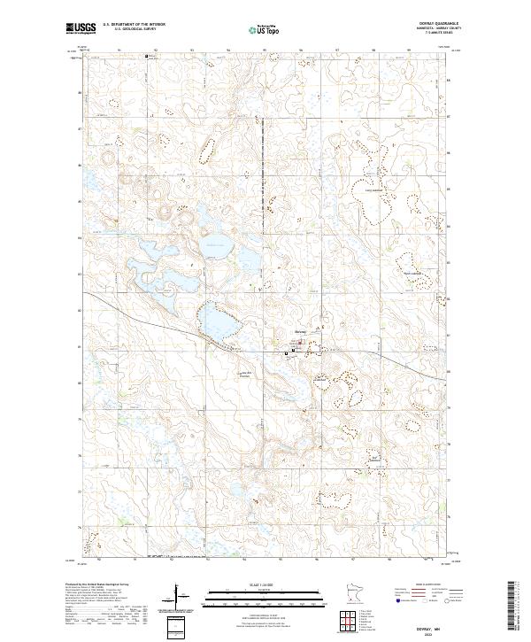
2022 Map of Dovray
USGS Topo · Published 2022About this map
The Coteau des Prairies upland plateau dominates this portion of Murray County, where the village of Dovray sits amidst a landscape defined by its glacial history. The region is characterized by numerous basins, many of which are identified as dry or seasonal beds including Duck Lakebed, Long Lakebed, and Rush Lakebed. These drainage patterns feed into the Des Moines River, which snakes through the southwestern corner of the quadrangle, and its local tributaries like Devils Run.
Find a feature on this map
44 named features on this map. Tap any name to fly to it.
Don’t see what you’re looking for? This feature index may not catch every label — zoom into the map to look around manually.
Map Details
Editions of this 2022 Dovray Map
This is the sole edition of this map. No revisions or reprints were ever made.
Other maps of this area

1953 · New Ulm
USGS Topo · 1:250,000

1954 · Fairmont
USGS Topo · 1:250,000

1957 · New Ulm
USGS Topo · 1:250,000

1958 · New Ulm
USGS Topo · 1:250,000

1958 · Fairmont
USGS Topo · 1:250,000

1967 · New Ulm
USGS Topo · 1:250,000

1967 · Walnut Grove
USGS Topo · 1:24,000

1967 · Tracy East
USGS Topo · 1:24,000
1967 · Tracy West
USGS Topo · 1:24,000

1967 · Dovray
USGS Topo · 1:24,000