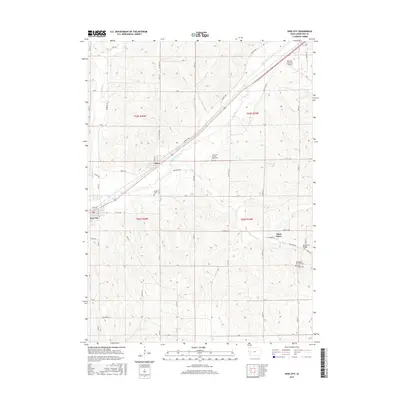
2015 Map of Dow City
USGS Topo · Published 2015About this map
Boyer River valleys dominate this portion of Crawford County, where the historic path of the Lincoln Way follows the shelf of the river's northern bank. The town of Dow City serves as a primary hub alongside the Chicago and North Western Railway corridor, while the smaller settlements of Arion and Buck Grove maintain their positions at key intersections of the rail and road network. The landscape is characterized by a high density of small tributary streams like Willow Creek and Buck Creek that have carved the rolling terrain of western Iowa. Local heritage is preserved in several rural burial sites, including the Washington Township Cem and the Butler Cem. On the northeastern edge, the Denison Municipal Airport represents the modern transportation infrastructure alongside the established grid of county roads such as Co HWY e59.
Find a feature on this map
55 named features on this map. Tap any name to fly to it.
Don’t see what you’re looking for? This feature index may not catch every label — zoom into the map to look around manually.
Map Details
Editions of this 2015 Dow City Map
This is the sole edition of this map. No revisions or reprints were ever made.
Other maps of this area

1954 · Omaha
USGS Topo · 1:250,000

1954 · Fort Dodge
USGS Topo · 1:250,000

1957 · Omaha
USGS Topo · 1:250,000

1957 · Fort Dodge
USGS Topo · 1:250,000

1958 · Omaha
USGS Topo · 1:250,000

1958 · Fort Dodge
USGS Topo · 1:250,000

1971 · Earling
USGS Topo · 1:24,000

1971 · Dunlap
USGS Topo · 1:24,000

1971 · Earling NE
USGS Topo · 1:24,000

1971 · Denison
USGS Topo · 1:24,000