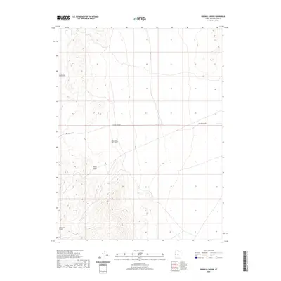
2020 Map of Dowdell Canyon
USGS Topo · Published 2020About this map
Cattlemens Little Valley sits along the western edge of this landscape, marking a point of interest in a region defined by dramatic elevation changes. The terrain is characterized by a series of deep cuts through the Confusion Range, where natural drainages have carved out Dowdell Canyon and Payson Canyon. These geographic features dictate the movement through the area, as seen in the linear path of Mile and a Half Rd, which cuts across the high desert flats before approaching the rugged ascent of Mile and a Half Canyon. This 2020 survey provides a clear view of the relationship between the few named landmarks and the steep, complex topography of Millard County, illustrating how limited access points like these canyons serve as the primary conduits through the range.
Find a feature on this map
6 named features on this map. Tap any name to fly to it.
Don’t see what you’re looking for? This feature index may not catch every label — zoom into the map to look around manually.
Map Details
Editions of this 2020 Dowdell Canyon Map
This is the sole edition of this map. No revisions or reprints were ever made.
Other maps of this area

1908 · Fish Springs
USGS Topo · 1:250,000

1910 · Fish Springs
USGS Topo · 1:250,000

1953 · Delta
USGS Topo · 1:250,000

1958 · Delta
USGS Topo · 1:250,000

1959 · Cowboy Pass
USGS Topo · 1:62,500

1960 · Notch Peak
USGS Topo · 1:62,500

1960 · Conger Mountain
USGS Topo · 1:62,500

1962 · Delta
USGS Topo · 1:250,000

1972 · Swasey Peak SW
USGS Topo · 1:24,000
1981 · Tule Valley
USGS Topo · 1:100,000