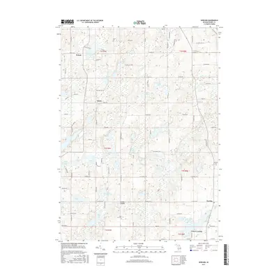
2017 Map of Dowling
USGS Topo · Published 2017About this map
Glacial kettle lakes and wetlands dominate this pocket of Barry County, where the rural settlements of Dowling and Cedar Creek serve as local anchors. The landscape is defined by its water, from the expansive Wall Lake and Shallow Lake in the southwest to the intricate drainage of the N Br Cedar Cr and Cedar Cr. Small communities and named crossroads like Podunk and Schultz appear alongside family-oriented landmarks, such as Tanner Cem and Cedar Creek Cem, which provide valuable touchpoints for genealogical research. The road network, including Root Rd and S Broadway St, follows the section lines of the Public Land Survey System, carving through a terrain of numerous smaller bodies of water like Larabee Lake, Zigler Lake, and Lily Lake. Near the southern boundary, Vickery Landing on Clear Lake indicates the area's transition into recreational shoreline use.
Find a feature on this map
104 named features on this map. Tap any name to fly to it.
Don’t see what you’re looking for? This feature index may not catch every label — zoom into the map to look around manually.
Map Details
Editions of this 2017 Dowling Map
This is the sole edition of this map. No revisions or reprints were ever made.
Other maps of this area

1918 · Battle Creek
USGS Topo · 1:62,500

1918 · Galesburg
USGS Topo · 1:62,500

1943 · Battle Creek
USGS Topo · 1:62,500

1944 · Galesburg
USGS Topo · 1:62,500

1947 · Delton
USGS Topo · 1:24,000

1947 · Banfield
USGS Topo · 1:24,000

1947 · Bedford
USGS Topo · 1:24,000

1947 · Galesburg
USGS Topo · 1:62,500

1950 · Galesburg
USGS Topo · 1:62,500

1950 · Battle Creek
USGS Topo · 1:62,500