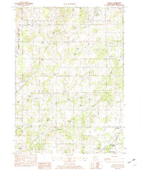
1982 Map of Dowling
USGS Topo · Published 1982About this map
Barry State Game Area dominates the northwestern corner of this 1980s landscape, where the town of Podunk sits near the intersection of Podunk Creek and Rutland Lake. This rural stretch of Michigan is defined by its dense concentration of glacial lakes, from the large Wall Lake and Big Cedar Lake in the south to smaller basins like Whitefish Lake and Tillotson Lake tucked into the rolling terrain. The map reveals a community structured around these water bodies and traditional crossroads, with the settlement of Dowling serving as a focal point near Dowling Cem.
Find a feature on this map
51 named features on this map. Tap any name to fly to it.
Don’t see what you’re looking for? This feature index may not catch every label — zoom into the map to look around manually.
Map Details
Editions of this 1982 Dowling Map
This is the sole edition of this map. No revisions or reprints were ever made.
Other maps of this area

1918 · Battle Creek
USGS Topo · 1:62,500

1918 · Galesburg
USGS Topo · 1:62,500

1943 · Battle Creek
USGS Topo · 1:62,500

1944 · Galesburg
USGS Topo · 1:62,500

1947 · Delton
USGS Topo · 1:24,000

1947 · Banfield
USGS Topo · 1:24,000

1947 · Bedford
USGS Topo · 1:24,000

1947 · Galesburg
USGS Topo · 1:62,500

1950 · Galesburg
USGS Topo · 1:62,500

1950 · Battle Creek
USGS Topo · 1:62,500