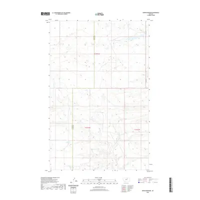
2020 Map of Down Reservoir
USGS Topo · Published 2020About this map
Down Reservoir serves as a central hydrological landmark in this northern Montana prairie landscape, situated near the jurisdictional line of Blaine Co and Phillips Co. The terrain is defined by the drainage patterns of Dodson Creek and its tributary, N Fork Dodson Creek, which weave through a series of subtle topographic depressions and seasonal wetlands. Human infrastructure is sparse, represented primarily by the linear path of N Dodson Rd on the eastern edge of the quadrangle. This 2020 digital survey reflects a modern high-plains environment where the Public Land Survey System grid, including townships t33n r26e and t32n r26e, continues to govern the distribution of land and water resources in a region primarily dedicated to rangeland and water management.
Find a feature on this map
8 named features on this map. Tap any name to fly to it.
Don’t see what you’re looking for? This feature index may not catch every label — zoom into the map to look around manually.
Map Details
Editions of this 2020 Down Reservoir Map
This is the sole edition of this map. No revisions or reprints were ever made.
Other maps of this area

1920 · Avery
USGS Topo · 1:125,000

1953 · Havre
USGS Topo · 1:250,000

1957 · Havre
USGS Topo · 1:250,000

1958 · Havre
USGS Topo · 1:250,000

1964 · Coburg
USGS Topo · 1:24,000

1964 · Dodson
USGS Topo · 1:24,000

1964 · Dodson Dam
USGS Topo · 1:24,000

1984 · Emerick Bench
USGS Topo · 1:24,000
1984 · Hubert Hill SW
USGS Topo · 1:24,000
1984 · Down Reservoir NW
USGS Topo · 1:24,000