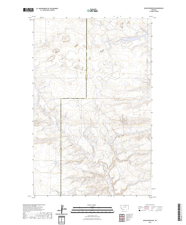
2024 Map of Down Reservoir
USGS Topo · Published 2024About this map
Down Reservoir lies at the heart of this North Central Montana landscape, marking a critical water resource in a region defined by its drainage systems. The terrain is shaped by the winding paths of North Fork Dodson Creek and Dodson Creek, which carve through the plains near the border of Blaine and Phillips Counties. The map illustrates the sparsely settled nature of the area, where land use is oriented around these seasonal watercourses and the section lines of the Public Land Survey System.
Find a feature on this map
9 named features on this map. Tap any name to fly to it.
Don’t see what you’re looking for? This feature index may not catch every label — zoom into the map to look around manually.
Map Details
Editions of this 2024 Down Reservoir Map
This is the sole edition of this map. No revisions or reprints were ever made.
Other maps of this area

1920 · Avery
USGS Topo · 1:125,000

1953 · Havre
USGS Topo · 1:250,000

1957 · Havre
USGS Topo · 1:250,000

1958 · Havre
USGS Topo · 1:250,000

1964 · Coburg
USGS Topo · 1:24,000

1964 · Dodson
USGS Topo · 1:24,000

1964 · Dodson Dam
USGS Topo · 1:24,000

1984 · Emerick Bench
USGS Topo · 1:24,000
1984 · Hubert Hill SW
USGS Topo · 1:24,000
1984 · Down Reservoir NW
USGS Topo · 1:24,000