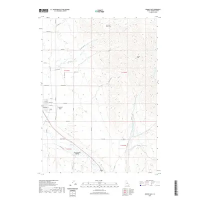
2020 Map of Downey East
USGS Topo · Published 2020About this map
Marsh Valley serves as the focal point for this eastern Idaho landscape, where the agricultural flats meet the rising slopes of the Portneuf Range. The town of Downey is situated along the western edge of the quadrangle, supported by infrastructure including the Downey / Hyde Memorial Airport and the Portneuf Marsh Valley Canal. The map reveals a high density of rural cemeteries, such as Cambridge Cem and Grant Ward Cem, which speak to the long-standing family settlements of this region. To the south, Downata Hot Springs emerges as a distinct landmark near the small settlement of Zenda. The drainage network is complex, defined by the Left Hand Fork Marsh Creek and Right Hand Fork Marsh Creek, which channel water from the high canyons down toward the central valley floor.
Find a feature on this map
53 named features on this map. Tap any name to fly to it.
Don’t see what you’re looking for? This feature index may not catch every label — zoom into the map to look around manually.
Map Details
Editions of this 2020 Downey East Map
This is the sole edition of this map. No revisions or reprints were ever made.
Other maps of this area

1915 · Preston
USGS Topo · 1:96,000

1918 · Preston
USGS Topo · 1:125,000

1948 · Bancroft
USGS Topo · 1:62,500

1949 · Bancroft
USGS Topo · 1:62,500

1954 · Pocatello
USGS Topo · 1:250,000

1955 · Preston
USGS Topo · 1:250,000

1958 · Pocatello
USGS Topo · 1:250,000

1958 · Preston
USGS Topo · 1:250,000

1962 · Preston
USGS Topo · 1:250,000

1968 · Malad Summit
USGS Topo · 1:24,000