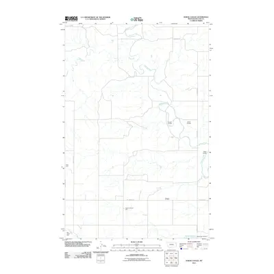
2011 Map of Dowse Coulee
USGS Topo · Published 2011About this map
The Redwater River and Sheep Creek wind through the open ranching country of McCone County in this 2011 survey. The landscape is defined by its drainage patterns, with prominent features such as Dowse Coulee, Davis Coulee, and Alkali Coulee carving through the terrain. Human modification of the arid environment is evident in the numerous small-scale irrigation and livestock water works, including the Robert Johnson Dam, Heslo Dam, and Paul Huber Dam.
Find a feature on this map
15 named features on this map. Tap any name to fly to it.
Don’t see what you’re looking for? This feature index may not catch every label — zoom into the map to look around manually.
Map Details
Editions of this 2011 Dowse Coulee Map
This is the sole edition of this map. No revisions or reprints were ever made.
Other maps of this area

1912 · Chelsea
USGS Topo · 1:62,500

1912 · Poplar
USGS Topo · 1:62,500

1954 · Glendive
USGS Topo · 1:250,000

1954 · Wolf Point
USGS Topo · 1:250,000

1957 · Glendive
USGS Topo · 1:250,000

1958 · Wolf Point
USGS Topo · 1:250,000

1958 · Glendive
USGS Topo · 1:250,000

1972 · Chelsea SW
USGS Topo · 1:24,000

1972 · Poplar
USGS Topo · 1:24,000
1972 · Nickwall
USGS Topo · 1:24,000