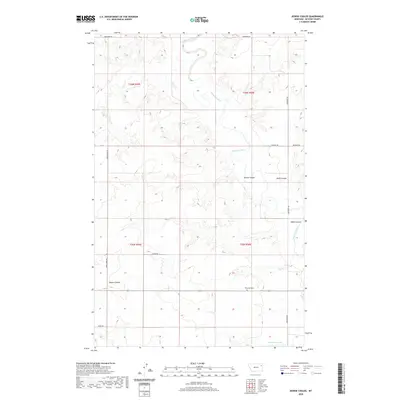
2020 Map of Dowse Coulee
USGS Topo · Published 2020About this map
The Redwater River snakes through the northern reaches of this McCone County landscape, carving a winding path through the high plains of eastern Montana. This 2020 topographic record shows a pastoral region defined by its drainage systems, where significant geological formations like Dowse Coulee and Davis Coulee channel water toward the river basin. For genealogists and local historians, the presence of Riverside Cem near the intersection of Redwater Rd and the local connector provides a specific point of reference for family research in this sparsely populated area.
Find a feature on this map
19 named features on this map. Tap any name to fly to it.
Don’t see what you’re looking for? This feature index may not catch every label — zoom into the map to look around manually.
Map Details
Editions of this 2020 Dowse Coulee Map
This is the sole edition of this map. No revisions or reprints were ever made.
Other maps of this area

1912 · Chelsea
USGS Topo · 1:62,500

1912 · Poplar
USGS Topo · 1:62,500

1954 · Glendive
USGS Topo · 1:250,000

1954 · Wolf Point
USGS Topo · 1:250,000

1957 · Glendive
USGS Topo · 1:250,000

1958 · Wolf Point
USGS Topo · 1:250,000

1958 · Glendive
USGS Topo · 1:250,000

1972 · Chelsea SW
USGS Topo · 1:24,000

1972 · Poplar
USGS Topo · 1:24,000
1972 · Nickwall
USGS Topo · 1:24,000