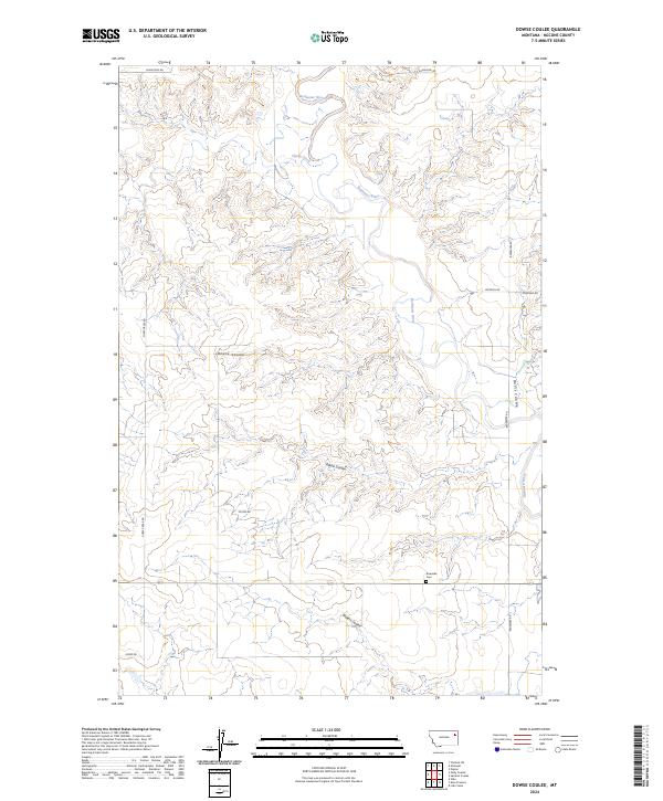
2024 Map of Dowse Coulee
USGS Topo · Published 2024About this map
The Redwater River winds through this McCone County landscape, carving a network of drainage features including Dowse Coulee and Alkali Coulee. This 2024 survey reflects the modern rural structure of the region, where family-named roads like Dietrich Rd, Doornek Rd, and Olson Rd provide access to remote acreage. The presence of Riverside Cem near the riverbank serves as a critical point for local historians and genealogists tracing early inhabitants of this section of Montana. The terrain is defined by its hydraulic history, with seasonal watercourses like Sheep Creek and Waters Coulee dictating the placement of ranch access routes such as Loges Rd and Sheep Creek Rd.
Find a feature on this map
18 named features on this map. Tap any name to fly to it.
Don’t see what you’re looking for? This feature index may not catch every label — zoom into the map to look around manually.
Map Details
Editions of this 2024 Dowse Coulee Map
This is the sole edition of this map. No revisions or reprints were ever made.
Other maps of this area

1912 · Chelsea
USGS Topo · 1:62,500

1912 · Poplar
USGS Topo · 1:62,500

1954 · Glendive
USGS Topo · 1:250,000

1954 · Wolf Point
USGS Topo · 1:250,000

1957 · Glendive
USGS Topo · 1:250,000

1958 · Wolf Point
USGS Topo · 1:250,000

1958 · Glendive
USGS Topo · 1:250,000

1972 · Chelsea SW
USGS Topo · 1:24,000

1972 · Poplar
USGS Topo · 1:24,000
1972 · Nickwall
USGS Topo · 1:24,000