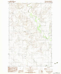
1983 Map of Dowse Coulee
USGS Topo · Published 1983About this map
The Redwater River winds through this section of McCone County, Montana, defining a landscape shaped by narrow drainages and expansive plateaus. This 1983 provisional survey highlights the intricate network of coulees that feed into the river system, including the namesake Dowse Coulee and the nearby Alkali Coulee. These geographical features were essential markers for early settlers and ranchers navigating the high plains. The presence of Waters Reservoir and the winding course of Sheep Creek underscore the importance of water management in this arid northern environment. The map captures the area just as modern surveying techniques were being finalized, providing a clear view of the rural sections and terrain before significant later developments. Researchers will find a preserved look at the township and range lines as they intersect with natural landmarks like Waters Coulee and Davis Coulee.
Find a feature on this map
7 named features on this map. Tap any name to fly to it.
Don’t see what you’re looking for? This feature index may not catch every label — zoom into the map to look around manually.
Map Details
Editions of this 1983 Dowse Coulee Map
This is the sole edition of this map. No revisions or reprints were ever made.
Other maps of this area

1912 · Chelsea
USGS Topo · 1:62,500

1912 · Poplar
USGS Topo · 1:62,500

1954 · Glendive
USGS Topo · 1:250,000

1954 · Wolf Point
USGS Topo · 1:250,000

1957 · Glendive
USGS Topo · 1:250,000

1958 · Wolf Point
USGS Topo · 1:250,000

1958 · Glendive
USGS Topo · 1:250,000

1972 · Chelsea SW
USGS Topo · 1:24,000

1972 · Poplar
USGS Topo · 1:24,000
1972 · Nickwall
USGS Topo · 1:24,000